


- Monday 8:00 AM - 5:00 PM
- Tuesday 8:00 AM - 5:00 PM
- Wednesday 8:00 AM - 5:00 PM
- Thursday 8:00 AM - 5:00 PM
- Friday 8:00 AM - 5:00 PM
- Saturday 8:00 AM - 12:00 PM
- Sunday Closed
Stock #
157019
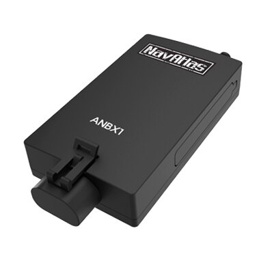
NavAltas External Navigation Box (Android OS)
In Stock
Dealer Price
$349.99 CAD
Overview
Specifications
extra
- Compatible with DXU1100DVR & DXP1001DVR
- Navigate with maps and tools tailored specifically for off-road use
- Record off-road trails and waypoints and share them with friends who can view on their PC, phones, or navigate to them using their own NavAtlas navigation.
- Location Management System allows you to save and organize your favorite locations so that you can return to them later using NavAtlas Expedition s maps or its specialized location finding tools.
- GPX file import/export for trails and waypoints on Android devices using NavAtlas Utilities, available on Google Play Store, is required.
- Reports Navigational compass and GPS information in real-time
- Waypoint creation tools: Enter coordinates, drop a pin on the map, save your current position.
- Search by map coordinates
- GPS Satellites graph and position charts
- Sunrise/Sunset time indicator
- Pairs with NAV160 Bluetooth GPS booster, available at your local NavAtlas dealer. GPS receiver is recommended in areas that have excessive interference or poor GPS reception in order to get a faster GPS lock
Category Name
Atv / Utv
Sale Type
New
Manufacturer
NavAltas
Fits On
GPS Speedometer
Fits On
GPS Speedometer
Category Name
Atv / Utv
Sale Type
New
Manufacturer
NavAltas
Quantity
1
Fits On
GPS Speedometer